• Starting Point Wheatland Bar - RM 72
  • End Point San Salvador - RM 57
  • Why this Trip

    It provides a wonderful look at the backchannel of Wheatland Bar, immediately across from the put-in. This put-in is a relatively short drive from Portland, and you have a great selection of campsite options, as well as the flexibility to make this a one or two night adventure, depending on your preferences.

  • Conditions and Equipment

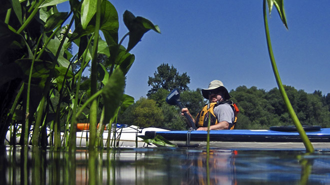
    This stretch is fairly wide and flat, with gentle current in the summer months. Canoes, kayaks and SUPs work well here.

  • Amenity Highlights

    If you launch from Willamette Mission State Park on river right, it has fee parking and restrooms. San Salvador has parking on gravel lot, it is a remote location, so don’t leave valuables in your vehicle, or park elsewhere if you plan to leave your vehicle overnight (perhaps consider extending your trip to Newberg’s Roger’s Landing). Camping highlights include Grand Island or Wheatland Bar, DSL Island, Nicol Sanctuary, Five Island and more!

  • Trip Description

    The backchannel has state-owned lands on both sides. A couple of nice islands can be explored on this stretch. There are several camping opportunities on state lands and a wide slow-moving channel along the last few miles into San Salvador Park.

    Whether you camp or just hike, be sure to explore one of our newer sites- the Nicol Sanctuary.  There is a nice group camp site here as well as a signed “Loop Trail” that is enjoyable to walk. Willamette Riverkeeper owns and stewards this property.

    From Interstate 5, take the Keizer exit (260A) and follow Lockhaven Drive to River Road (Highway 219). Head north for about a half mile and veer left onto Wheatland Road, then travel for about 7 miles, following the signs to Wheatland Ferry. The turn for the Willamette Mission boat ramp is just before the ferry landing.

  1. Wheatland Ferry

      1. Parking, Overnight
      2. Vehicle Access/Parking
      • River Mile 72
      • Latitude 45.09069
      • Longitude -123.04654

    LoadingThis Marion County ferry, which runs for part of the week, makes frequent trips back and forth across the river when in operation ($3). Paddlers should watch carefully, as people…

    Continue Reading

  2. Wheatland Boat Ramp

      1. Boat Ramp
      2. Vehicle Access/Parking
      • River Mile 72
      • Latitude 45.09294
      • Longitude -123.04179

    LoadingJust downstream of the ferry, this boat ramp provides ready access to the river and parking (payment required for parking).

    Continue Reading

  3. Ediger Landing

      • River Mile 72
      • Latitude 45.09227
      • Longitude -123.04477

    LoadingA large gravel bar across from Wheatland Boat Ramp.

    Continue Reading

  4. Wheatland Bar

      1. Camping
      • River Mile 72-70
      • Latitude 45.10189
      • Longitude -123.02114

    LoadingThis large island, over 1 1/2 miles long, has a wonderful back channel with a fantastic mix of willow, Oregon ash, and cottonwood lining the banks. Owned by the Oregon…

    Continue Reading

  5. Grand Island Access

      1. Picnic Table
      2. Restrooms-Seasonal, Rustic
      3. Trash Can
      4. Vehicle Access/Parking
      • River Mile 71
      • Latitude 45.10397
      • Longitude -123.02193

    LoadingThis OPRD park is on the back channel of Wheatland Bar. Although there is vehicle access to the edge of the park, the area is quiet and has seasonal toilets.…

    Continue Reading

  6. Eldridge Bar Landing

      1. Camping
      2. Picnic Table
      3. Wildlife
      • River Mile 70-69
      • Latitude 45.11349
      • Longitude -122.99871

    LoadingPrimitive rustic site, but now with a new picnic table thanks to OPRD! During lower water flows, you have to paddle up the back channel to access this OPRD camp…

    Continue Reading

  7. Lambert Bar

      1. Camping
      • River Mile 65
      • Latitude 45.1605
      • Longitude -123.03185

    LoadingThis small OPRD park is at the confluence of Lambert Slough and the Willamette, at the end of the 10-mile slough’s course back to the main river. It is ideal…

    Continue Reading

  8. DSL Island 64

      • River Mile 64
      • Latitude 45.16305
      • Longitude -123.01542

    LoadingThere is some shade here, camp anywhere (note: view the map in satellite mode to locate the islands).

    Continue Reading

      • River Mile 63.5
      • Latitude 45.1658
      • Longitude -122.99918

    Continue Reading

  9. Five Island

      1. Camping
      2. Wildlife
      • River Mile 62
      • Latitude 45.17771
      • Longitude -123.01362

    LoadingThis island has great scenery, a shallow and flowing back channel, and multiple camping options. The best camping is along the mainstem side anywhere on the large gravel bar, or…

    Continue Reading

  10. Coffee Island

      1. Camping
      • River Mile 61
      • Latitude 45.19504
      • Longitude -123.01881

    LoadingA low gravel-bar island with several flat areas where a tent could be pitched. (no amenities)  (view map in satellite mode to locate island)

    Continue Reading

  11. Candiani Bar

      1. Camping
      2. Wildlife
      • River Mile 59
      • Latitude 45.21458
      • Longitude -123.04902

    LoadingA large island with a very nice back channel. The mainstem side of the island consists of a large gravel bar backed by cottonwood and Pacific willow. Now and then…

    Continue Reading

  12. Yamhill Landing

      1. Camping
      • River Mile 59-58
      • Latitude 45.21802
      • Longitude -123.05134

    LoadingA large, undeveloped landing suitable for primitive camping along the shoreline. (no amenities)

    Continue Reading

  13. San Salvador Park

      1. Boat Ramp, Rustic
      2. Vehicle Access/Parking
      • River Mile 56.75
      • Latitude 45.22225
      • Longitude -123.02774

    LoadingA small park with a crude boat ramp and limited parking. It is an important access point on the Water Trail and heavily used in the summer. It is owned…

    Continue Reading

Comments

  1. Great trip. Just did it for Father’s Day. One day is plenty. Took about 4 hrs of paddling. Lots of good bars for lunch stops. Very unspoiled section of river. No bridges, very few powerlines or anything. Lots of birds.

  2. We did a great 3 day trip. Independence to Boone’s Ferry. Camped at Darrow and Candiani. Experience the transition from farming (with irrigation pumps) to mansions.

  3. Had a good ~5hr Kayak trip, 15.2 miles with an average speed of 3mph or ~9 min/ml. Got out and walked along the Upper Lambert Bar with the kayak in tow. Did a shorter walk across the Weston bar. The water was deep enough, we just wanted to stretch our legs.

Add a Comment

All commments are reviewed by the web site administrator before posting.