Blue Ruin Island
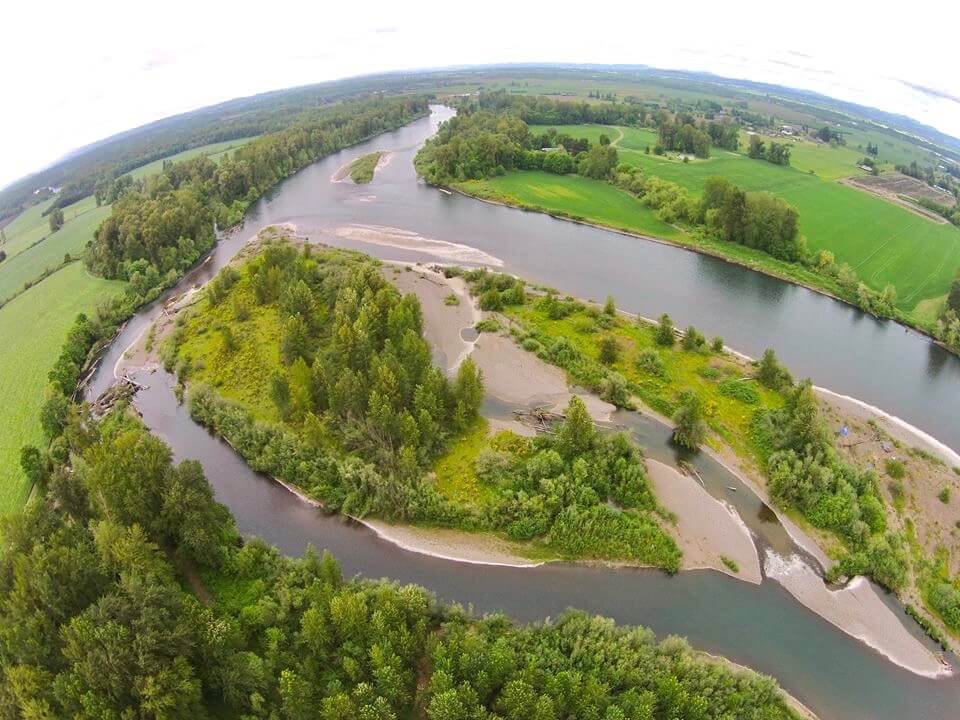
This is a large island with a small backchannel, usually year-round, but the channel is reliable full of wood. It has little protection from the sun, but offers a flat areas for camping. You can camp anywhere on the island. The upper end has a lot of willows. Look for the Water Trail sign on the mainstem side of the island about midway down. (This aerial image of the island is looking upstream, with the mainstem pictured on the right.)
Note: When you paddle downstream from here, don’t be surprised when you paddle past a Water Trail sign on river left, around RM 162, posted as “Blue Ruin.” This is another OPRD campsite that is available to you, although it is NOT labled on the first edition of the printed Water Trail maps.
Cody Jul 7, 2017
Great spot to camp! Group of 10 to 12 stopped here back to back years for the night. We basically left our boats on beach on the main river and then hiked over to the slough and made camp towards the north end of the island. For fun we would hike to the south part of the island in our life jackets and then float the slough from the top to the bottom of the island. Each year we had the island to ourselves. We would make camp right where they are camping in the main image for Blue Ruin.
Judson Brown Jul 7, 2017
Camped at the top of the island where the side channel separates. Noticed an even nicer site a couple hundred yards down the main channel, river right on the left side of the island. Very confused by the giant sign announcing Blue Ruin on river left about 2 mi. downstream, in a place that doesn’t seem to offer any camping…(Note from moderator: There is camping at either “Blue Ruin” location)