• Starting Point Bryant Park - RM 120
  • End Point Independence Riverview Park - RM 96
  • Why this Trip

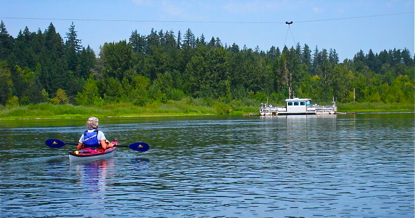
    You can see an abundance of wildlife and experience the confluence of the Luckiamute and Santiam Rivers near Luckiamute State Natural Area.

  • Conditions and Equipment

    This is a large open section of river with only a few areas of fast moving water.

  • Amenity Highlights

    There is parking and restrooms at both Bryant Park and Takena Landing in Albany. By calling ahead, you can get permission to park overnight. Independence has free parking and restrooms.

  • Trip Description

    This trip can be done overnight, as there are campsites along the way.

  1. Bryant Park

      1. Picnic Table
      2. Restrooms
      3. Vehicle Access/Parking
      4. Water
      • River Mile 120
      • Latitude 44.6398
      • Longitude -123.1124

    LoadingA good place to put in or take out from the gravel beach for day paddles or extended trips.

    Continue Reading

  2. Takena Landing

      1. Boat Ramp
      • River Mile 119.5
      • Latitude 44.63992
      • Longitude -123.10658

    LoadingHas a boat ramp for launching. Watch the bridge pilings for debris at high water!

    Continue Reading

  3. Bowman Park

      1. Boat Ramp, Rustic
      2. Picnic Table
      3. Restrooms
      4. Vehicle Access/Parking
      • River Mile 118.5
      • Latitude 44.64299
      • Longitude -123.08616

    LoadingThis park can be used as a lunch stop if traveling from Albany.

    Continue Reading

  4. Black Dog Landing

      1. Wildlife
      • River Mile 111-12
      • Latitude 44.71028
      • Longitude -123.14264

    LoadingThis is a rustic Greenway. Keep an eye out for wildlife such as deer, osprey, and eagle.

    Continue Reading

  5. Luckiamute State Natural Area

      1. Camping
      2. Fire Ring
      3. Hiking
      4. Picnic Table
      5. Restrooms-Seasonal, Rustic
      6. Vehicle Access/Parking
      7. Wildlife
      • River Mile 108-110
      • Latitude 44.74661
      • Longitude -123.13936

    LoadingThis is a fantastic Willamette River Greenway park. LSNA has grown from a collection of small parcels along the Willamette River to a 925-acre Natural Area managed as a single…

    Continue Reading

  6. Wells Island

      1. Wildlife
      • Latitude 44.77992
      • Longitude -123.13354

    LoadingThis is a scenic island just downstream of the Ferry. Note that the backchannel is often choked with navigation hazards such as wood. We do NOT recommend exploring the backchannel…

    Continue Reading

  7. American Bottom

      1. Camping
      2. Fire Ring
      3. Picnic Table
      4. Restrooms-Seasonal, Rustic
      5. Wildlife
      • River Mile 104
      • Latitude 44.79581
      • Longitude -123.1161

    LoadingThis OPRD Greenway parcel makes a very nice overnight campsite. It contains picnic tables, a seasonal toilet, and open grassy areas to camp in. Watch for purple camas–a native wildflower–in…

    Continue Reading

  8. Sidney Access

      • River Mile 102-101.25
      • Latitude 44.81533
      • Longitude -123.09327

    LoadingThis OPRD parcel has a steep and difficult bank, making any access very problematic. This is no longer a viable camp site. Improved access is a priority for this site…

    Continue Reading

  9. Judson Rocks

      1. Camping
      • River Mile 100
      • Latitude 44.82311
      • Longitude -123.11524

    LoadingGravel island with a few cottonwoods and willows. Nice views and relatively quiet, although within sight of homes. For the most optimal camp site, we recommend paddling right at the…

    Continue Reading

  10. Independence Bar Landing

      1. Camping
      • River Mile 97
      • Latitude 44.83154
      • Longitude -123.17414

    LoadingA 10-acre OPRD parcel, the landing has ample shade and a rough rock beach along the riverfront. While primitive camping is allowed, noise from occasional traffic can be heard. (no…

    Continue Reading

  11. Independence Island

      • River Mile 96
      • Latitude 44.84719
      • Longitude -123.18251

    Loading

    Continue Reading

  12. Independence Riverview Park

      1. Boat Ramp
      2. Camping
      3. Picnic Table
      4. Restrooms-Seasonal, Rustic
      5. Vehicle Access/Parking
      6. Water
      • River Mile 95.5
      • Latitude 44.85292
      • Longitude -123.18164

    LoadingThis is a nice city park that makes a good lunch stop or take-out/put-in. The park has toilets, and a short walk will take you to main street in downtown…

    Continue Reading

Comments

  1. I used this itinerary as a starting point for a ten person two-day trip and it was fabulous! We camped at American Bottom, which is basically just one big campsite. That was perfect for our group since luckily, no one else claimed it first.

    Osprey and herons were abundant and we found lots of lovely places to stop and swim.

    We had lunch in Independence on day two. Instead of ending there, we went on to Croft Vineyard, which has a beautiful riverfront property. You have to know exactly what you’re looking for to find it from the water. The winemakers were excellent hosts, letting us park a car there overnight. They have limited open hours, but great wine!

Add a Comment

All commments are reviewed by the web site administrator before posting.